The boundary line follows a watercourse for 2,100 kilometres (1,305 miles), from the intersection of the West Line boundary through the St. Lawrence River, the Great Lakes and interconnecting rivers. This section was originally surveyed by David Thompson and William Bird during the years 1817 to 1820. It was later surveyed and marked by the International Waterways Commission, which was established following the Treaty of 1908. Resurvey operations were later carried out by the International Boundary Commission during the period 1938 to 1946.
Section 13 - St. Lawrence River
The St. Lawrence is an active waterway both commercially and recreationally. Boundary reference monuments must be maintained in good condition in order to effectively respond to any question on the location of the line. The 193-kilometre (120-mile) section of the St. Lawrence River boundary is defined by 105 turning points that are referenced by 88 monuments.
C-1; C-2; C-3; C-4; C-5; C-6; C-7
Section 14 - Lake Ontario and Niagara River
The Lake Ontario and Niagara River stretches of the boundary were surveyed and marked by the International Waterways Commission survey of 1909-1913. The shoreline of the Niagara River is now highly developed as prime park and residential districts.
Section 15 - Lake Erie, Detroit and St. Clair Rivers
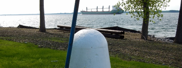
Lake Erie is becoming increasingly active for commercial and recreational fishing. To accommodate the fishermen, buoys were placed to mark the boundary through the western end of the lake. Considering the increasing cost of placing these buoys and the improvement in navigational equipment (Loran, GPS) the Commission discontinued the placement of the buoys in 1994. The boundary through the rivers and lake connecting Lake Erie and Lake Huron was originally surveyed by the International Waterways Commission in the years 1909 - 1913.
C-13; C-14; C-15; C-16; C-17; C-18; C-19
Section 16 - Lake Huron, St. Mary's River and Lake Superior
The boundary through the open waters of Lake Huron and Lake Superior presents few problems with respect to location or maintenance. However, through the connecting St. Marys River, industrial and residential development frequently disturbs the monuments referencing the boundary.
C-20; C-21; C-22; C-23; C-24; C-25; C-26
Section 17 - Lake Superior to Rainy River
The section of boundary from Lake Superior to Lake of the Woods, being almost entirely a water boundary, passes through 32 lakes and an equal number of connecting rivers.