The 49th Parallel boundary, east of the Rocky Mountains, was originally surveyed during the years 1872 to 1875. Determination of the parallel of latitude was by astronomic observations carried out at about 32-kilometre (20-mile) intervals. The final survey and mapping of the boundary, along the western end of the 49th Parallel, was completed in 1912 and 1913.
Section 19 - Meridian and 49th Parallel (MB/MN)
The Manitoba/Minnesota section of the line consists of 153 kilometres (95 miles) along the 49th Parallel and 42 kilometres (26 miles) along the Meridian Line north to the Northwesternmost Point of Lake of the Woods. The terrain is generally flat and swampy with a heavy growth of trees along much of the boundary.
E-53; E-54; E-55; E-56; E-57; E-58; E-59
Section 20 - 49th Parallel (MB/ND)
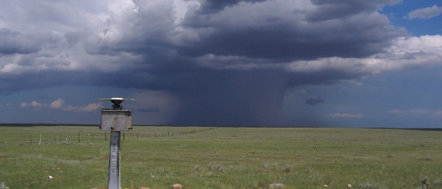
The North Dakota and the balance of the Manitoba international boundary passes mainly through open prairie, broken only by two minor mountain ranges. The Pembina Hills are forest-covered for a distance of 19 kilometres (12 miles), while the Turtle Mountains are tree-covered for a distance of 56 kilometres (35 miles). Turtle Mountain shelters the International Peace Garden. The Manitoba-North Dakota boundary is 300 kilometres (186 miles) in length
E-46; E-47; E-48; E-49; E-50; E-51; E-52
Section 21 - 49th Parallel (AB-SK/MT-ND)
The Prairie Section covers the North Dakota-Montana/Saskatchewan-Alberta portion of the boundary line which was resurveyed, mapped and monumented during the years 1909 through 1912. It extends for 885 kilometres (550 miles).
E-21; E-22; E-23; E-24; E-25; E-26; E-27; E-28; E-29; E-30; E-31; E-32; E-33; E-34; E-35; E-36; E-37; E-38; E-39; E-40; E-41; E-42; E-43; E-44; E-45
Section 22 - 49th Parallel (Foothills to West Kootenay River)
The boundary line through the Foothills and westward across the summit of the Rocky Mountains represents the Montana-Idaho/Alberta-British Columbia section of the international boundary. It is one of the most difficult sections of line to maintain. The boundary traverses mountain ranges upwards to 10,000 feet (3,050 metres) in elevation and few roads give access to the line. The entire section of line is heavily forested, with the exception of a few mountain peaks.
E-15; E-16; E-17; E-18; E-19; E-20
Section 23 - 49th Parallel (Similkameen River to West Kootenay River)
As with the boundary line from the Foothills to West Kootenay River, the Idaho - Washington/British Columbia boundary traverses several mountain ranges that are predominantly forest covered. However, growth becomes sparser westward from the Grand Forks, British Columbia-Danville, Washington area through the Okanagan, where climatic conditions are semi-arid. Considerable agricultural, commercial and mining interests have developed along the boundary west of Grand Forks-Danville.
E-8; E-9; E-10; E-11; E-12; E-13; E-14
Section 24 - 49th Parallel (Columbia Valley to Similkameen River)
The British Columbia/Washington boundary traversing the mountain ranges inland from the Pacific, presents one of the more difficult sections of the line to maintain. Mountains are abrupt and densely forested. Only one road intersects the boundary which makes access to the line very difficult.
Section 25 - 49th Parallel (Pacific to Columbia Valley)
The Fraser Valley (British Columbia/Washington), at the western end of the 49th Parallel section of the boundary, has been intensely developed both agriculturally and residentially. For this reason, and because of the prolific growth of vegetation, vista and monument maintenance along the boundary must be completed more frequently.